

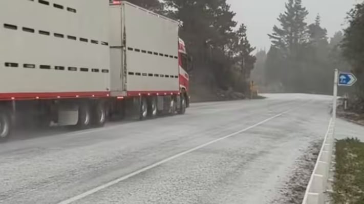

Coldest nights yet: Auckland could drop to -2°C, South Island near -10°C
New Zealand is bracing for some of its coldest nights of the year, with MetService warning that severe frosts will continue across much of the country as the polar blast persists.
According to a report by 1News, the prolonged cold spell has already driven electricity demand to a record high, while snow, ice and freezing temperatures continue to disrupt travel in several regions.
Transpower said New Zealand recorded its highest-ever electricity demand as households turned on heaters to cope with the freezing conditions.
"This morning we saw a new record for electricity use in New Zealand of 7247 MW as people across the country turned their heaters up as the polar blast moved in," the grid operator said, 1News has quoted.
To help manage the increased demand, Transpower issued several customer advice notices to electricity generators.
In a statement, the company said, "We've issued several customer advice notices this week as demand has climbed, helping support industry-wide coordination during these winter peaks and keeping the lights and heaters on for you," as quoted by 1News.
Despite the record demand, Transpower said there was no immediate risk to electricity supplies.
"We’re keeping a close eye on the situation, and while things are tight at this stage we don’t anticipate any impact to electricity supply, and we don’t need New Zealanders to take any action," 1News has quoted.
The latest MetService forecast predicts severe overnight frosts across large parts of both islands, with temperatures expected to fall even further over the next two nights.
Meteorologist John Law said the coldest conditions were still to come.
"The next few nights are going to be our coldest," as quoted by 1News.
He said Thursday night into Friday morning was expected to bring particularly low temperatures, even in northern parts of the country.
"So Thursday night into Friday, I think that's going to be a really chilly one, even up in towards Auckland and Northland," 1News has quoted.
Law said a shift in wind direction later in the week should bring some relief.
"But I think once we're heading in towards Friday, a bit of a change in our wind direction, back to more northerlies, so lose that cold southerly air over us. So temperatures getting a little bit better as we head through into the weekend," as quoted by 1News.
Some of the South Island's coldest locations, including Tekapo and Mount Cook Village, recorded overnight temperatures of between -7°C and -8°C.
Law warned that conditions would become even colder.
"Even up north, we've had some pretty cold temperatures, threes and fours, but with a bit of a breeze there it makes it feel much colder."
He added, "But it's worth saying, even if we thought last night was cold, the next few nights are probably going to be a couple of degrees colder. So you definitely need those extra layers, those gloves, and those extra woolly blankets."
The recent snowstorm caused widespread disruption, particularly in Dunedin, where emergency services responded to more than 20 weather-related incidents. Wellington also experienced a rare dusting of snow for the first time in almost a decade.
Law said eastern parts of the country had received the heaviest snowfall.
"So places like Dunedin, the Otago Peninsula, Banks Peninsula, with those showers just running through, and Christchurch further inland a lot drier," 1News has quoted.
He added, "Today, I think most of the showers are going to be across those eastern parts of the North Island. Mostly is rain, but a bit of a sleety mix in there, and some hail as we head through the day," as quoted by 1News.
Meanwhile, the New Zealand Transport Agency (NZTA) said road crews remained on standby to monitor highways vulnerable to snow and ice, particularly along State Highway 2 north and south of Gisborne.
The agency said temporary road closures could be introduced if conditions deteriorated.
"Please expect the possibility of a short-notice closure," as quoted by 1News.
NZTA stressed that closures would only be used as a last resort.
"Closing roads is our last resort, so other options to reduce/remove ice will be considered first, such as placing grit on the surface to improve vehicle grip, alongside the use of safety signage and traffic management to support positive driving behaviour," 1News has quoted.
State Highway 2 over Remutaka Hill reopened after crews cleared snow and ice from the route, while the Desert Road in the central North Island also reopened following an overnight closure.
Authorities continue to urge motorists to drive cautiously, reduce speed and remain alert as freezing temperatures and icy road conditions persist across the country.
New Zealand is bracing for some of its coldest nights of the year, with MetService warning that severe frosts will continue across much of the country as the polar blast persists.
{% module_block module "widget_2ed6ea5c-391f-4405-896e-cf059997e416" %}{% module_attribute "ads" is_json="true" %}{%...New Zealand is bracing for some of its coldest nights of the year, with MetService warning that severe frosts will continue across much of the country as the polar blast persists.
According to a report by 1News, the prolonged cold spell has already driven electricity demand to a record high, while snow, ice and freezing temperatures continue to disrupt travel in several regions.
Transpower said New Zealand recorded its highest-ever electricity demand as households turned on heaters to cope with the freezing conditions.
"This morning we saw a new record for electricity use in New Zealand of 7247 MW as people across the country turned their heaters up as the polar blast moved in," the grid operator said, 1News has quoted.
To help manage the increased demand, Transpower issued several customer advice notices to electricity generators.
In a statement, the company said, "We've issued several customer advice notices this week as demand has climbed, helping support industry-wide coordination during these winter peaks and keeping the lights and heaters on for you," as quoted by 1News.
Despite the record demand, Transpower said there was no immediate risk to electricity supplies.
"We’re keeping a close eye on the situation, and while things are tight at this stage we don’t anticipate any impact to electricity supply, and we don’t need New Zealanders to take any action," 1News has quoted.
The latest MetService forecast predicts severe overnight frosts across large parts of both islands, with temperatures expected to fall even further over the next two nights.
Meteorologist John Law said the coldest conditions were still to come.
"The next few nights are going to be our coldest," as quoted by 1News.
He said Thursday night into Friday morning was expected to bring particularly low temperatures, even in northern parts of the country.
"So Thursday night into Friday, I think that's going to be a really chilly one, even up in towards Auckland and Northland," 1News has quoted.
Law said a shift in wind direction later in the week should bring some relief.
"But I think once we're heading in towards Friday, a bit of a change in our wind direction, back to more northerlies, so lose that cold southerly air over us. So temperatures getting a little bit better as we head through into the weekend," as quoted by 1News.
Some of the South Island's coldest locations, including Tekapo and Mount Cook Village, recorded overnight temperatures of between -7°C and -8°C.
Law warned that conditions would become even colder.
"Even up north, we've had some pretty cold temperatures, threes and fours, but with a bit of a breeze there it makes it feel much colder."
He added, "But it's worth saying, even if we thought last night was cold, the next few nights are probably going to be a couple of degrees colder. So you definitely need those extra layers, those gloves, and those extra woolly blankets."
The recent snowstorm caused widespread disruption, particularly in Dunedin, where emergency services responded to more than 20 weather-related incidents. Wellington also experienced a rare dusting of snow for the first time in almost a decade.
Law said eastern parts of the country had received the heaviest snowfall.
"So places like Dunedin, the Otago Peninsula, Banks Peninsula, with those showers just running through, and Christchurch further inland a lot drier," 1News has quoted.
He added, "Today, I think most of the showers are going to be across those eastern parts of the North Island. Mostly is rain, but a bit of a sleety mix in there, and some hail as we head through the day," as quoted by 1News.
Meanwhile, the New Zealand Transport Agency (NZTA) said road crews remained on standby to monitor highways vulnerable to snow and ice, particularly along State Highway 2 north and south of Gisborne.
The agency said temporary road closures could be introduced if conditions deteriorated.
"Please expect the possibility of a short-notice closure," as quoted by 1News.
NZTA stressed that closures would only be used as a last resort.
"Closing roads is our last resort, so other options to reduce/remove ice will be considered first, such as placing grit on the surface to improve vehicle grip, alongside the use of safety signage and traffic management to support positive driving behaviour," 1News has quoted.
State Highway 2 over Remutaka Hill reopened after crews cleared snow and ice from the route, while the Desert Road in the central North Island also reopened following an overnight closure.
Authorities continue to urge motorists to drive cautiously, reduce speed and remain alert as freezing temperatures and icy road conditions persist across the country.





Leave a Comment